Online Quality Assurance For Spatial Data Made Easy!
checkgeodata.net executes automatic checks of your spatial data. Both – you, and your data supplier, get immediate feedback on the data quality automatically! Approved spatial data is processed immediately while edits and resubmissions are reduced to a minimum.
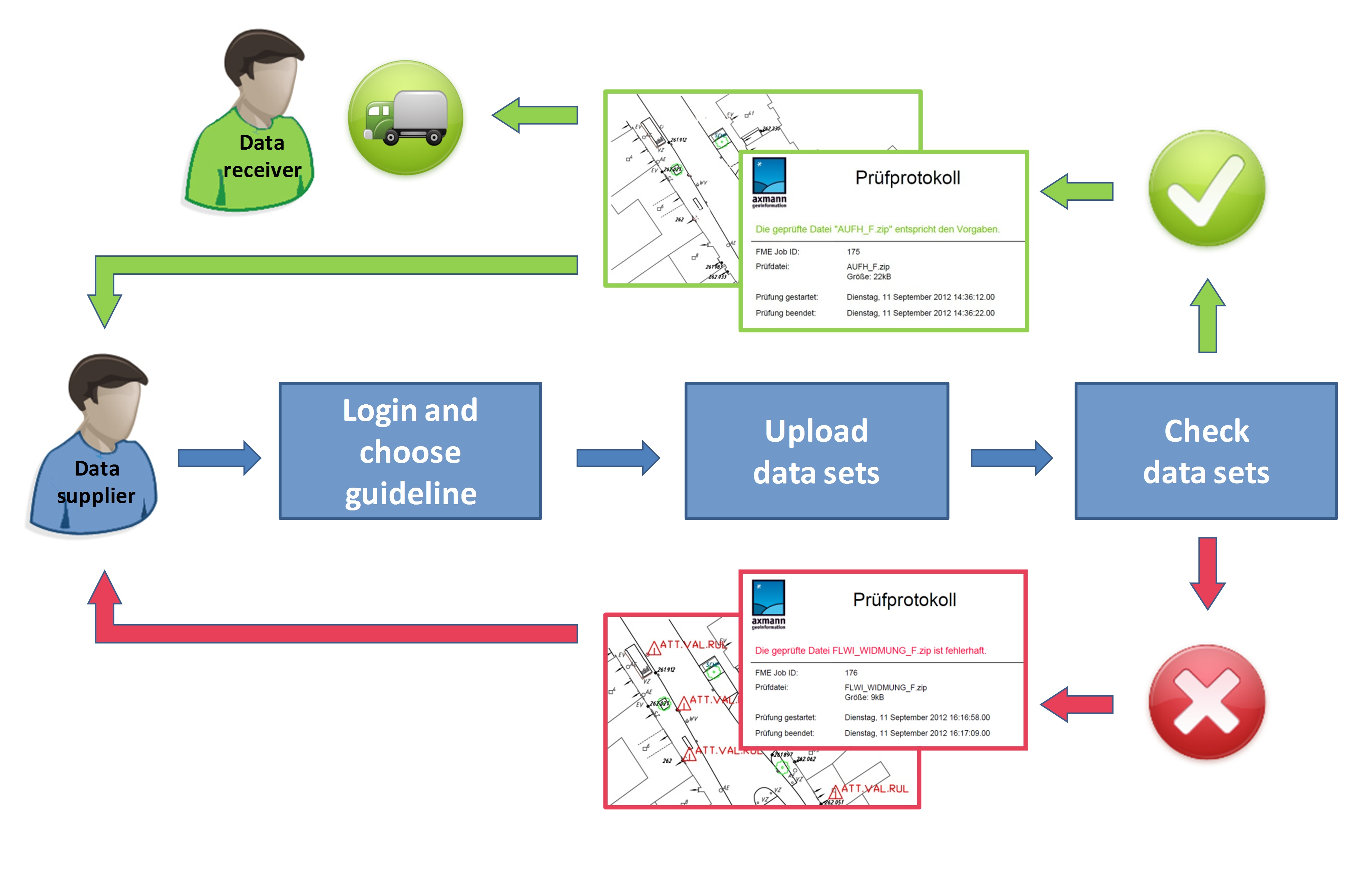
Here's how easy it is:
- Login and choose your specification
- Upload the file
- Start the validation
- View the results in your personal check archive
- Validation OK – Download the data quality certificate and deliver (a standardised delivery workflow is also included if needed).
- Validation Fails – Download the report and the geocoded error file to support quick correction, back to step 2
Interested in checking your specifications? Get more information
here!